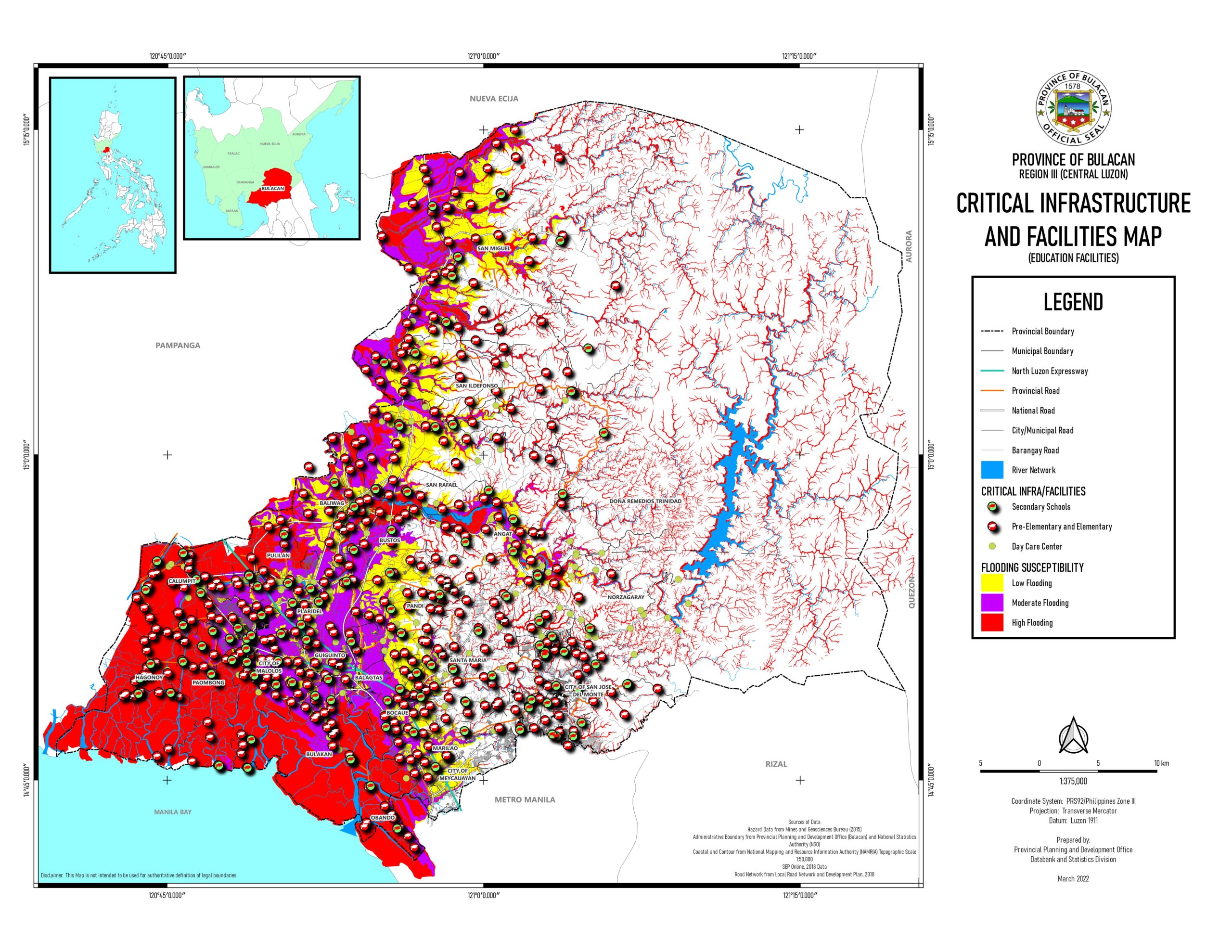
 Critical infrastructure and facilities map – Education | 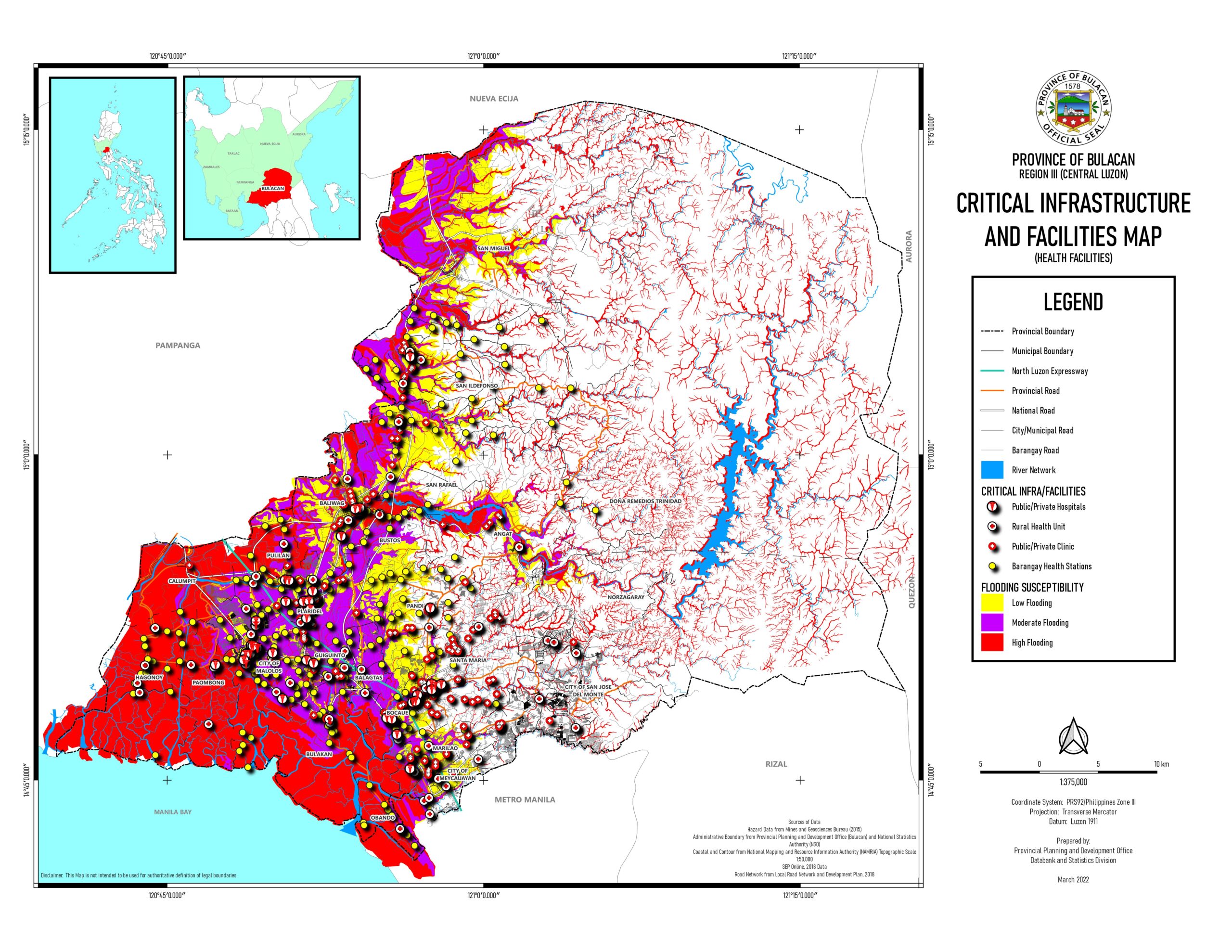 Critical infrastructure and facilities map – Health | 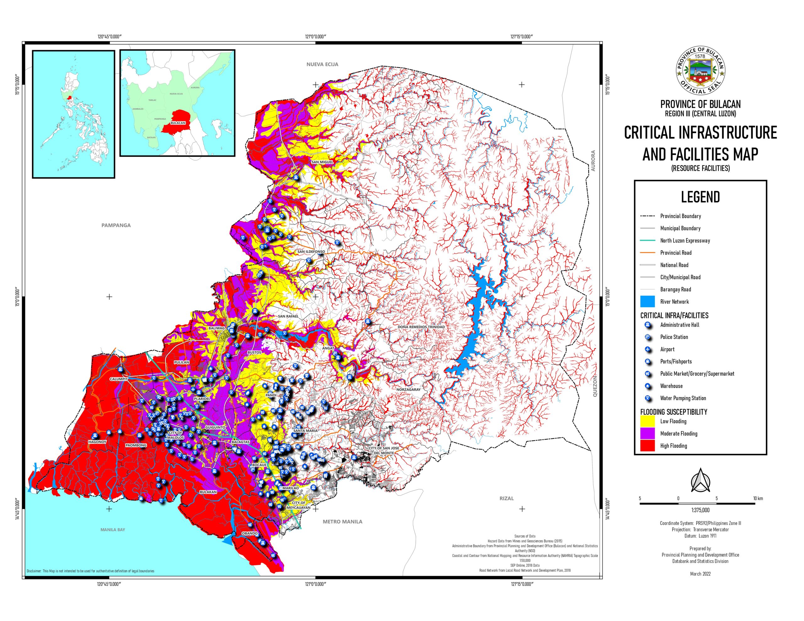 Critical infrastructure and facilities map – Resources | Critical infrastructure and facilities map – Transportation | 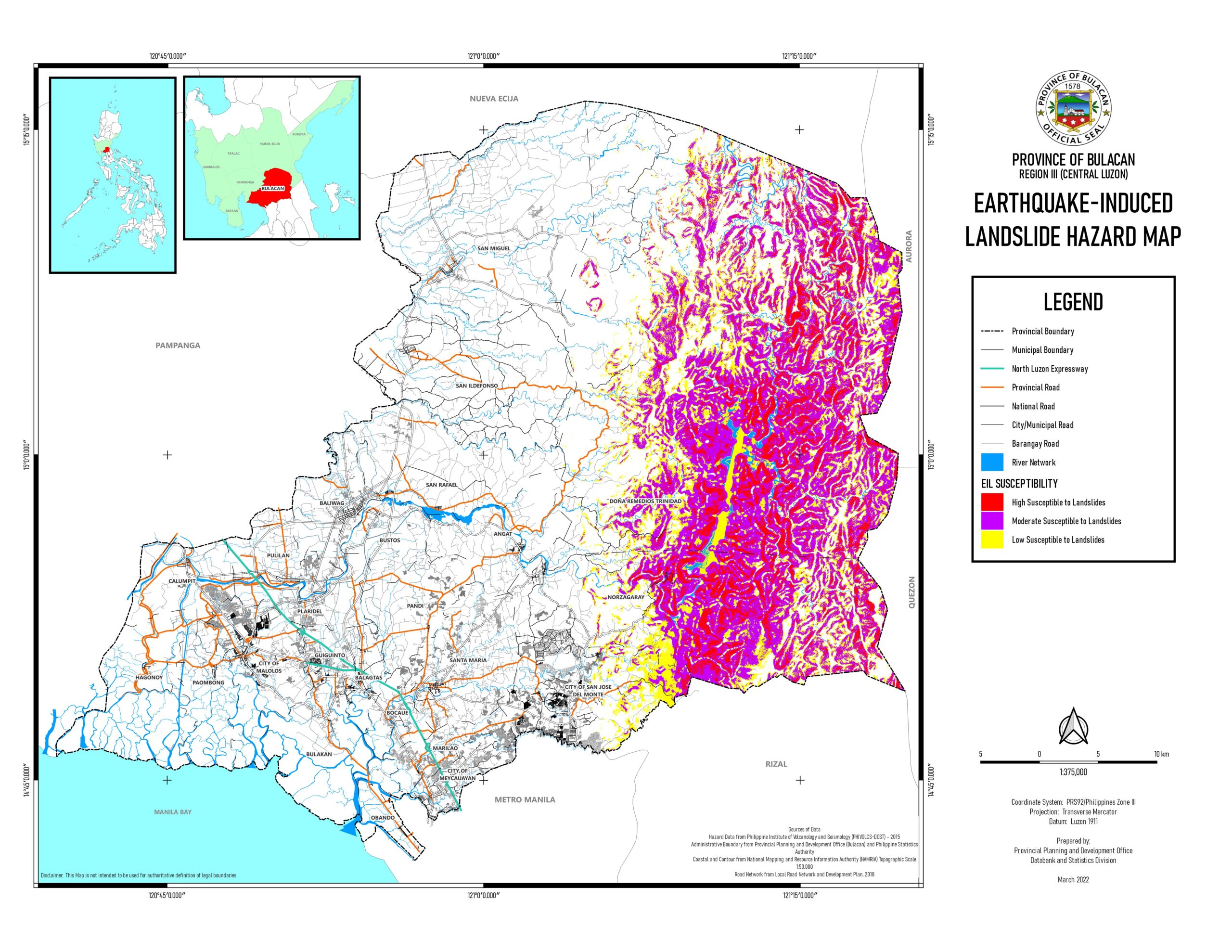 Earthquake – induced landslide hazard map |
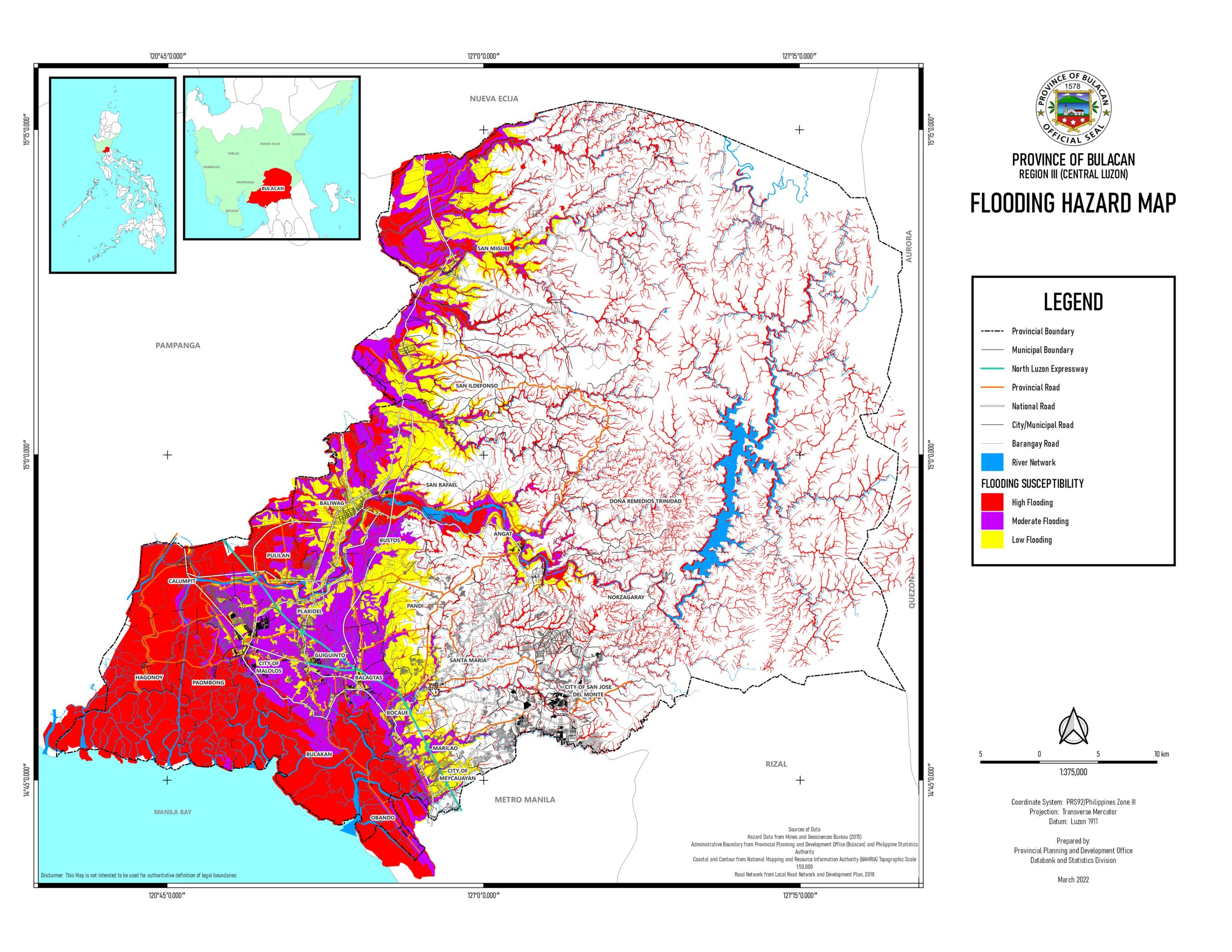 Flooding hazard map | 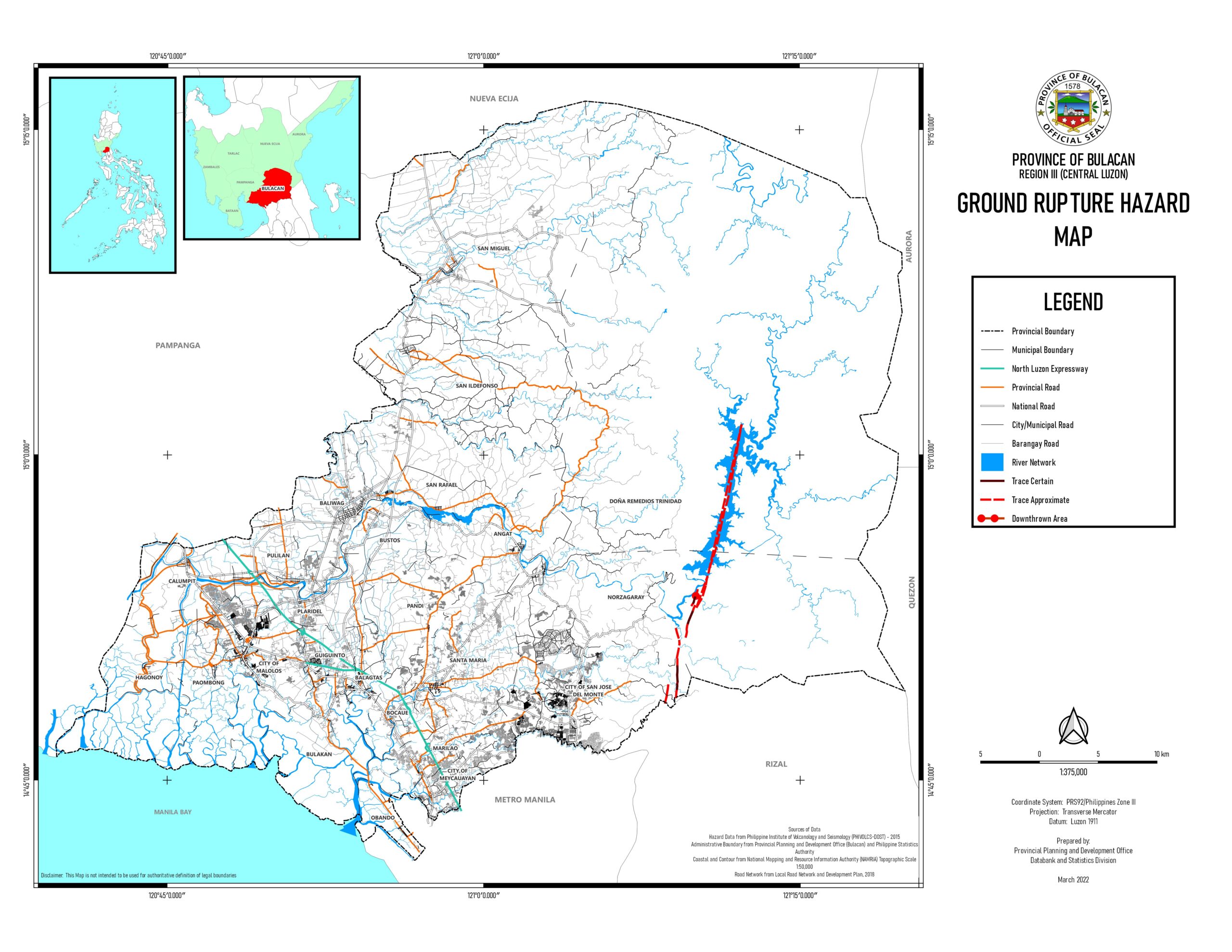 Ground Rupture hazard map | 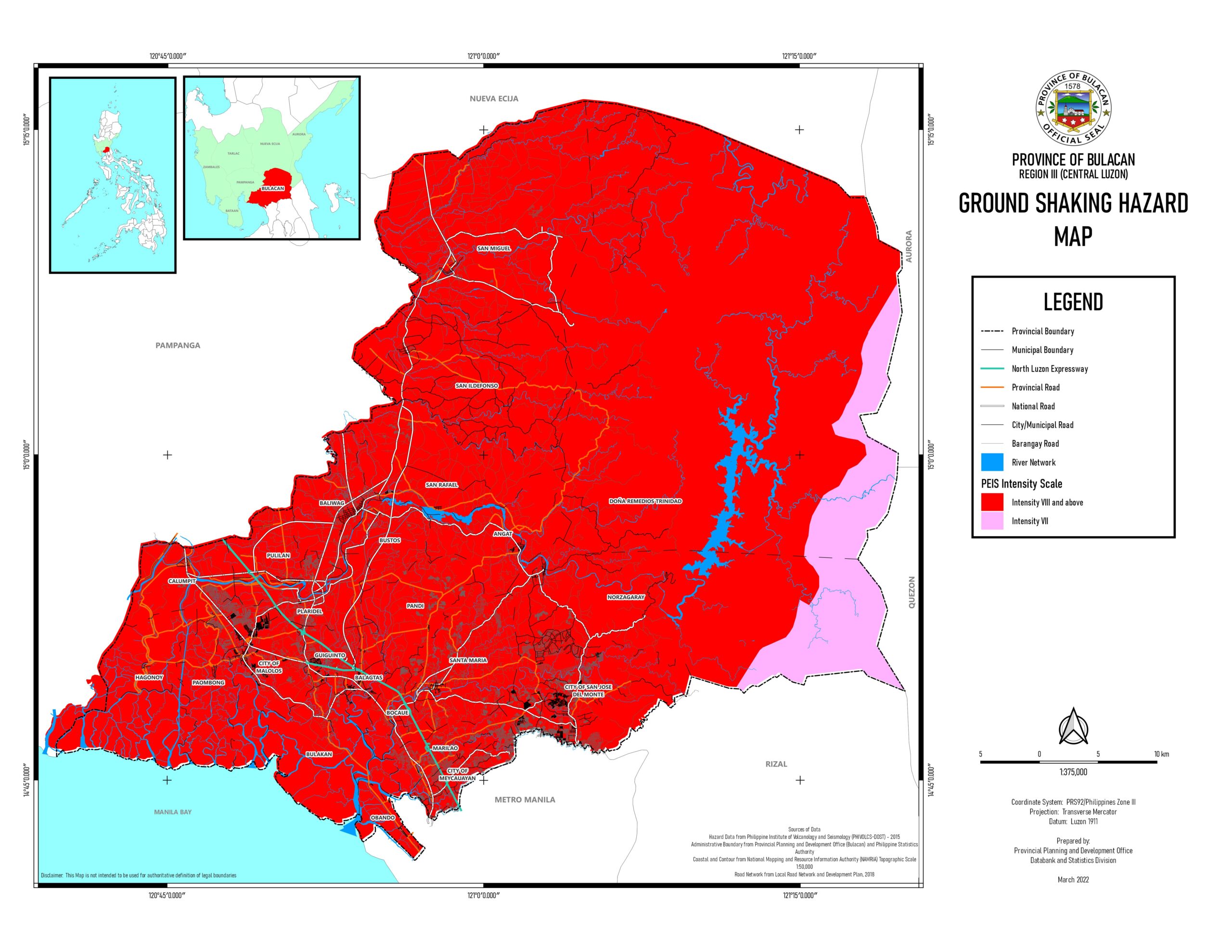 Ground shaking hazard map | 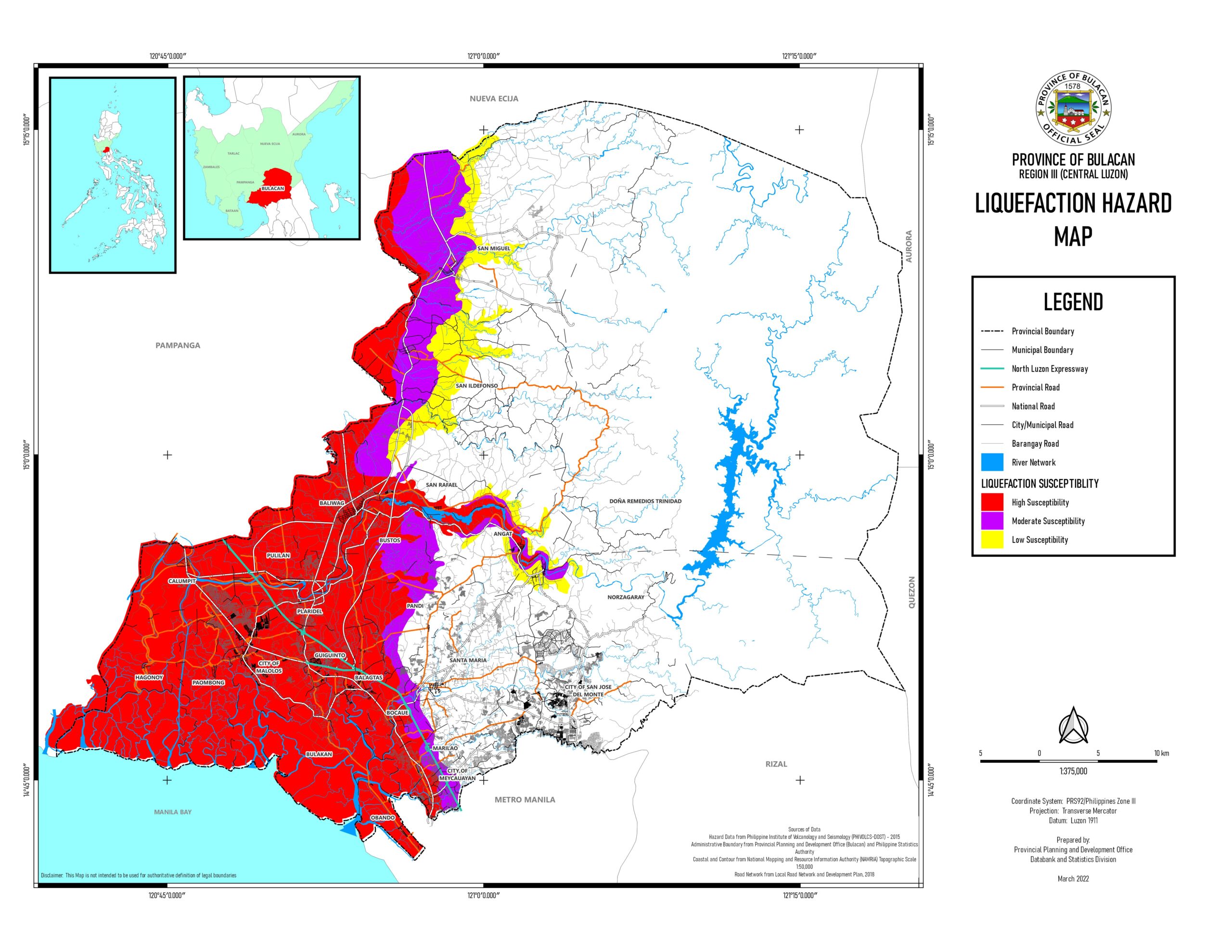 Liquefaction hazard map | 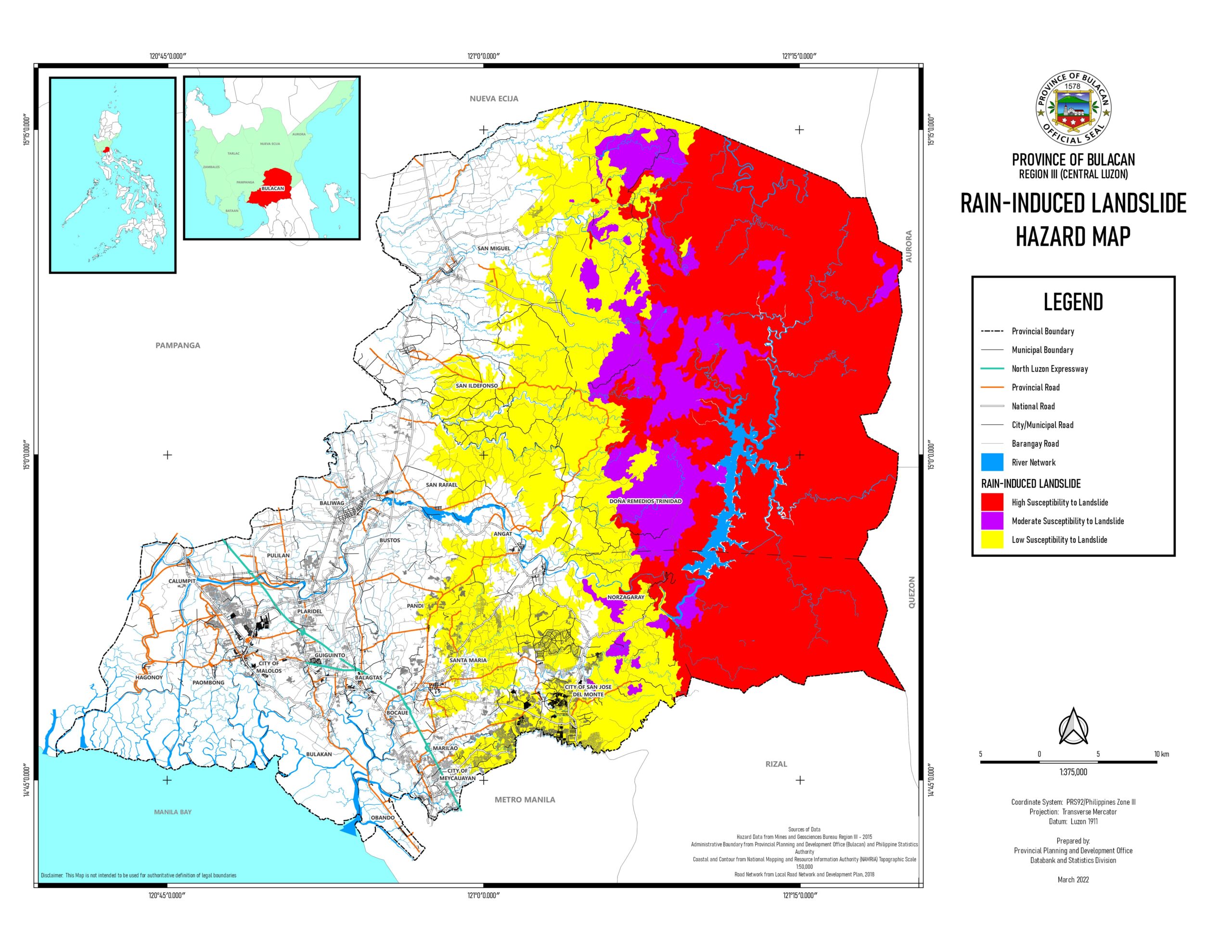 Rain – induced landslide hazard map |
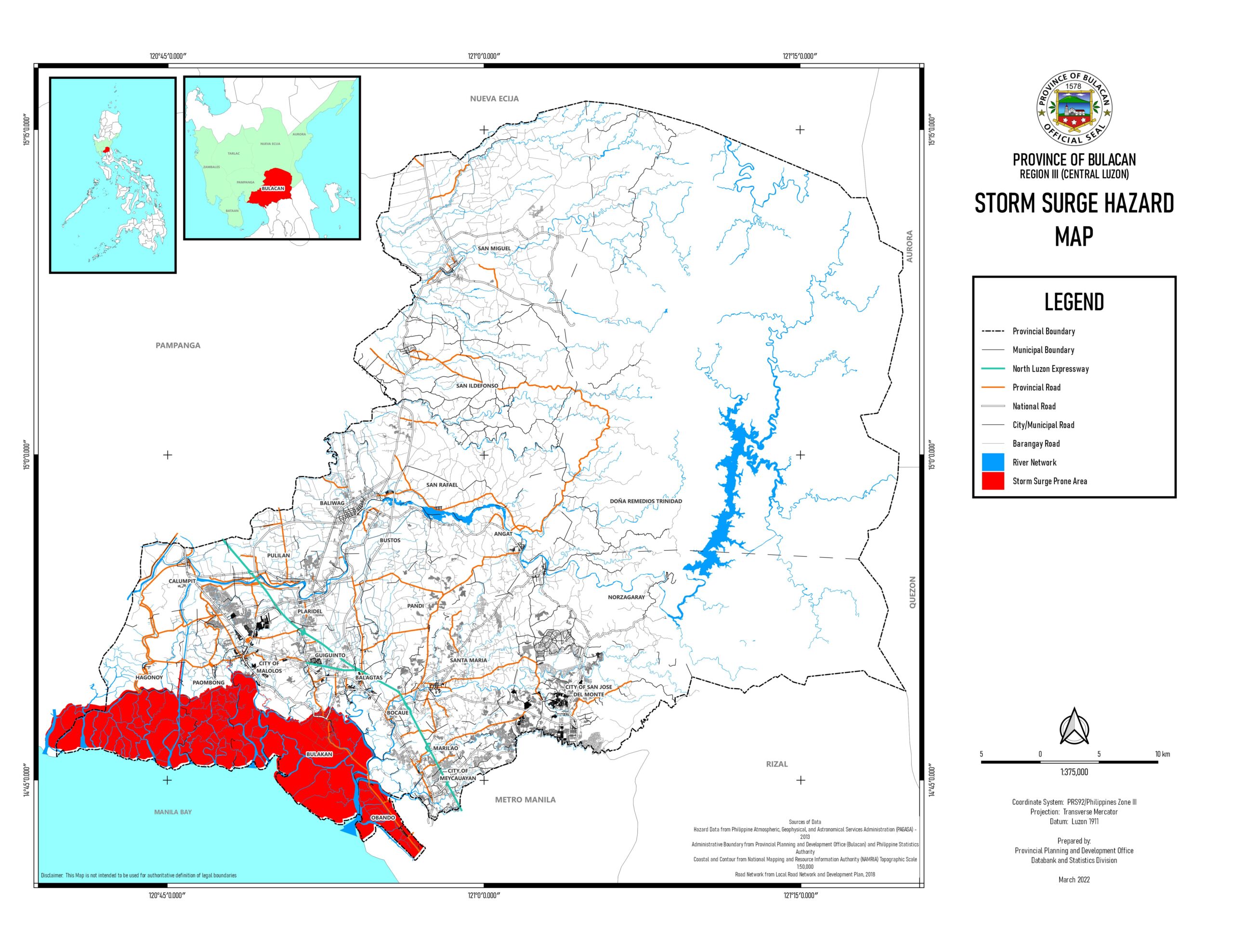 Storm surge hazard map | 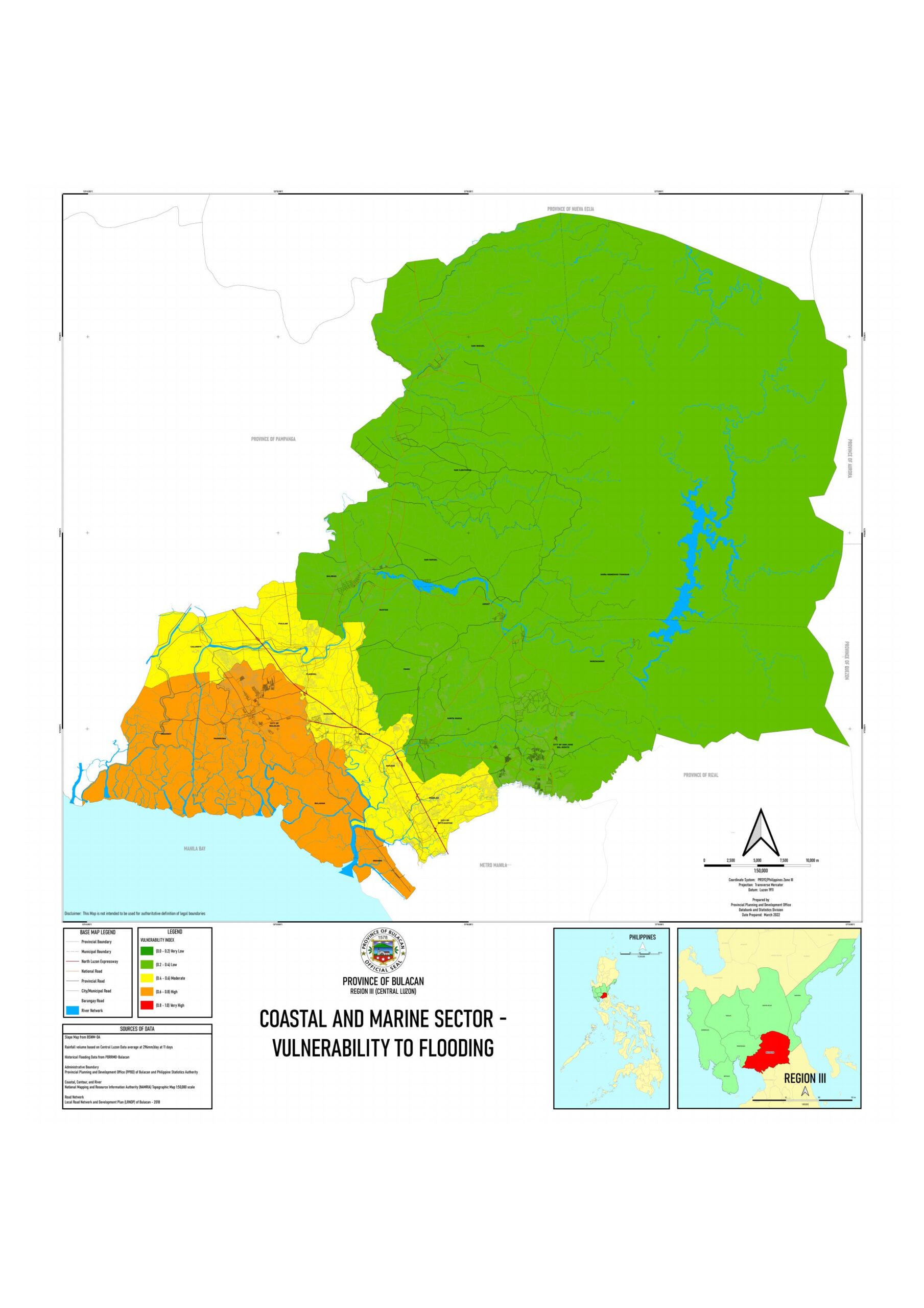 Vulnerability and susceptibility map – 1 |  Vulnerability and susceptibility map – 2 | 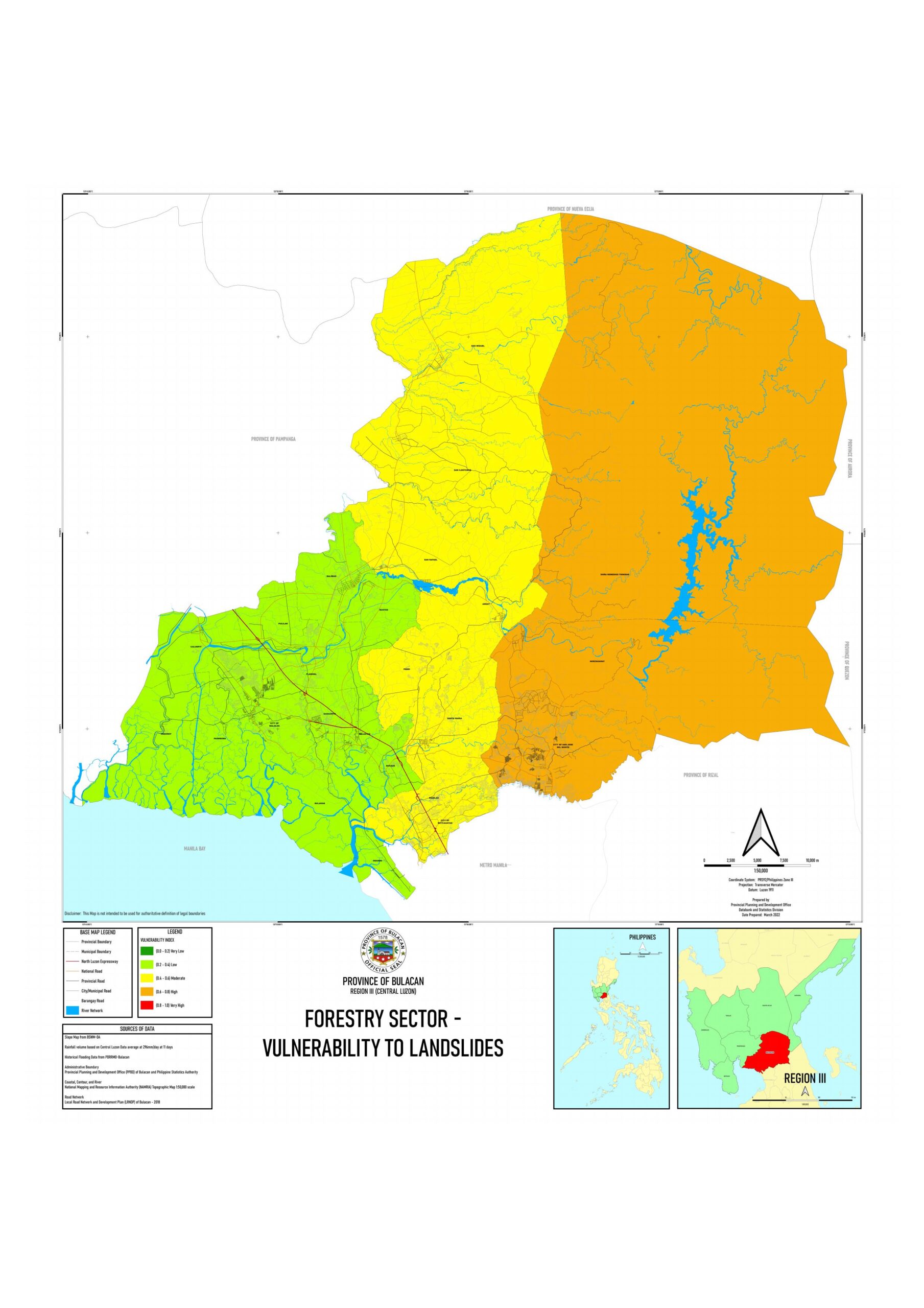 Vulnerability and susceptibility map – 3 | 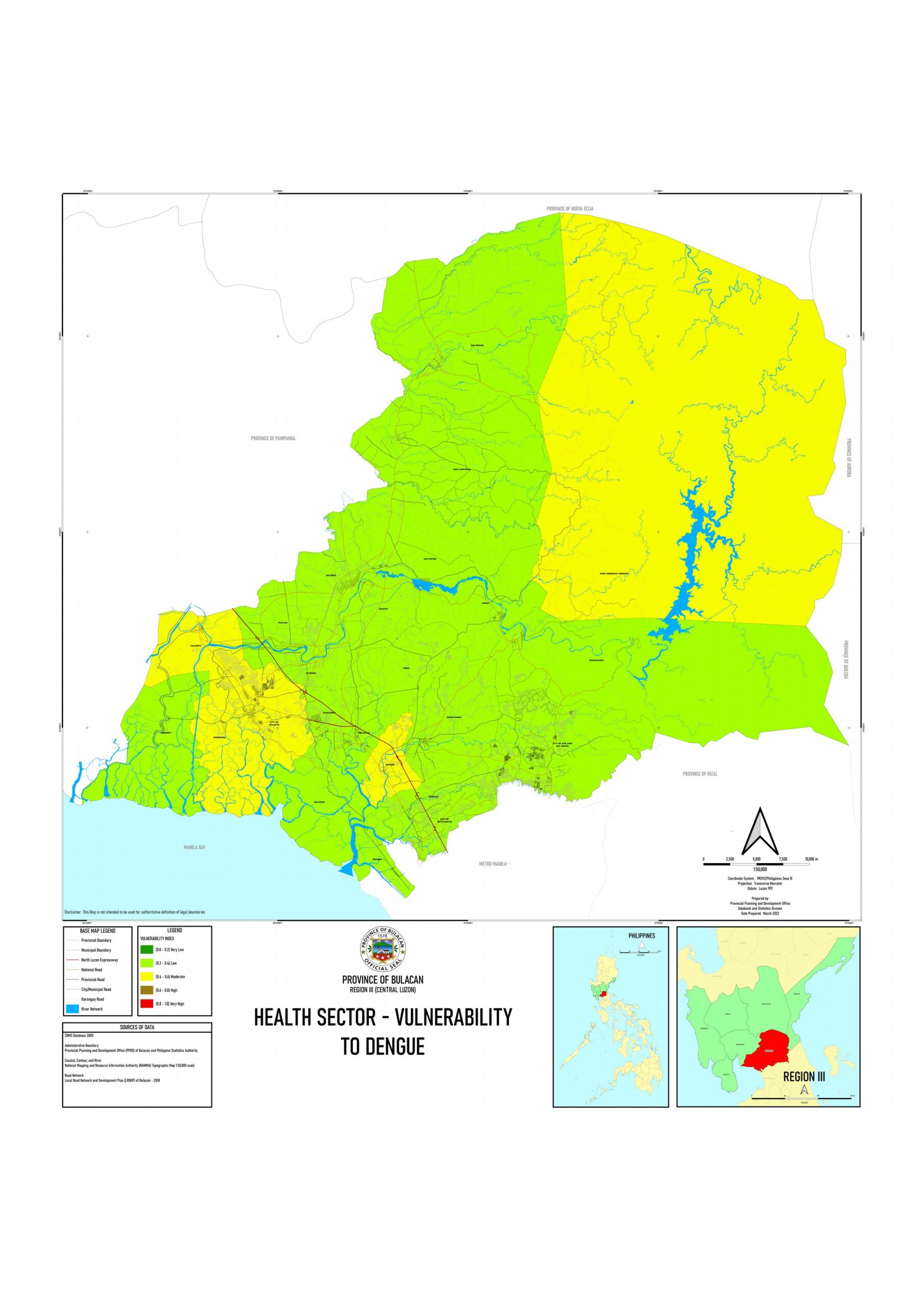 Vulnerability and susceptibility map – 4 |
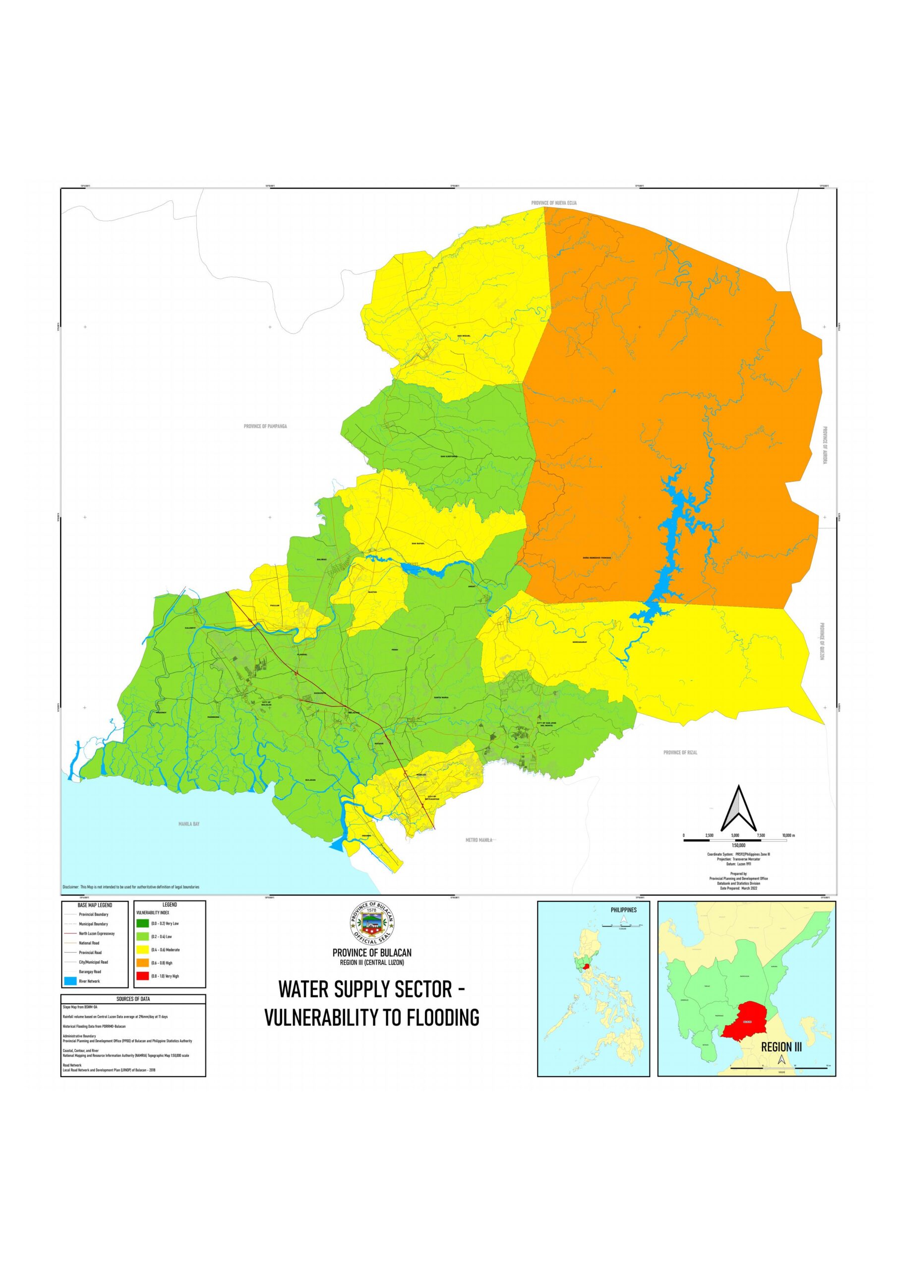 Vulnerability and susceptibility map – 5 | 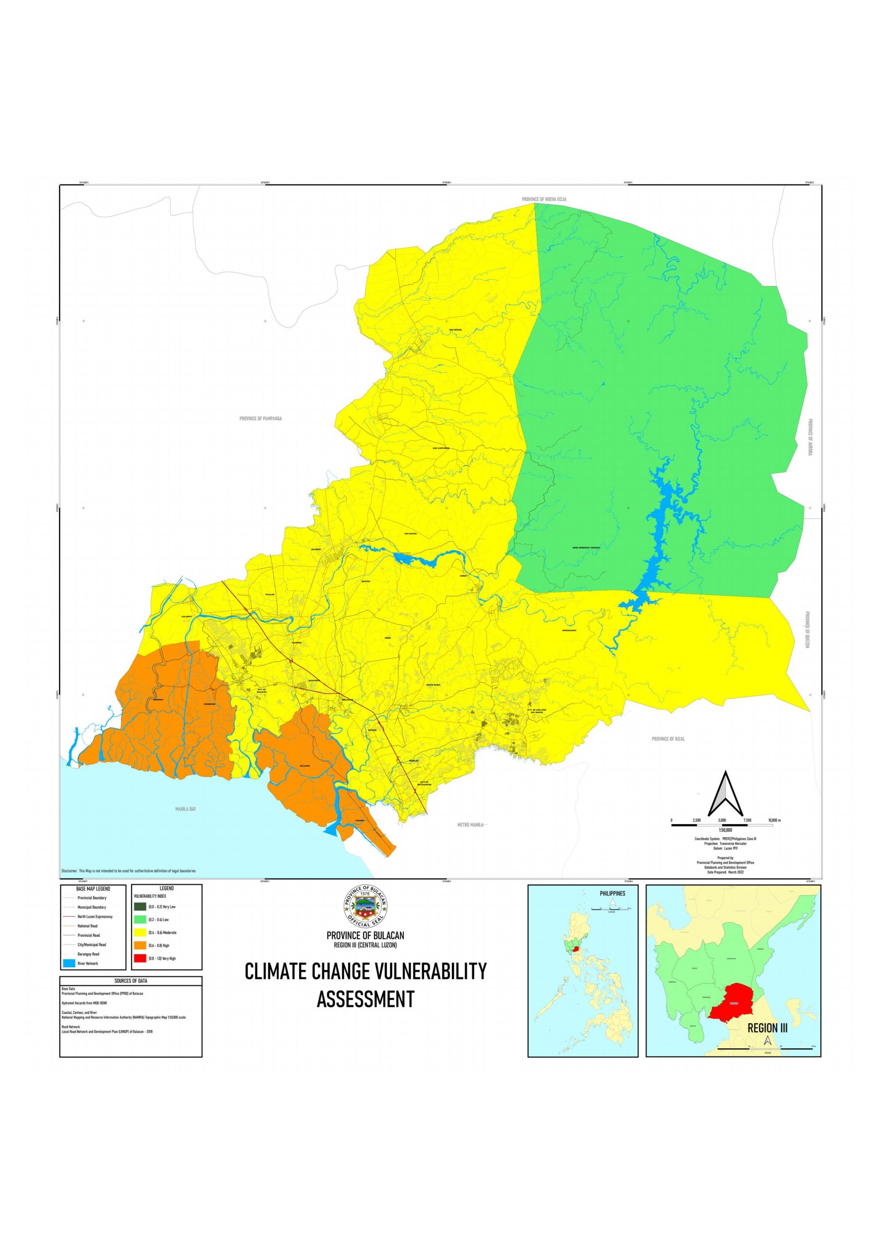 Vulnerability and susceptibility map – 6 | 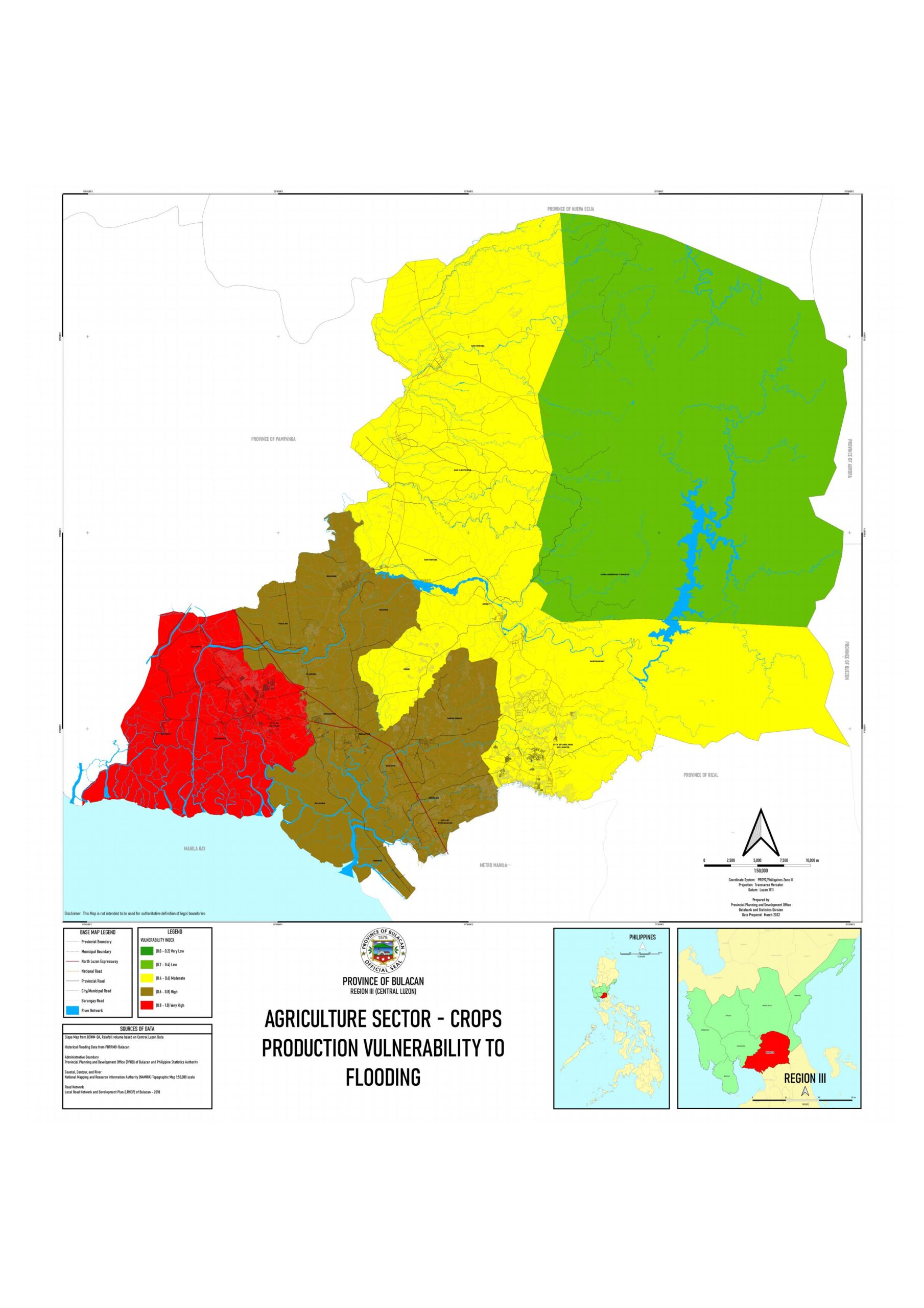 Vulnerability and susceptibility map – 7 | 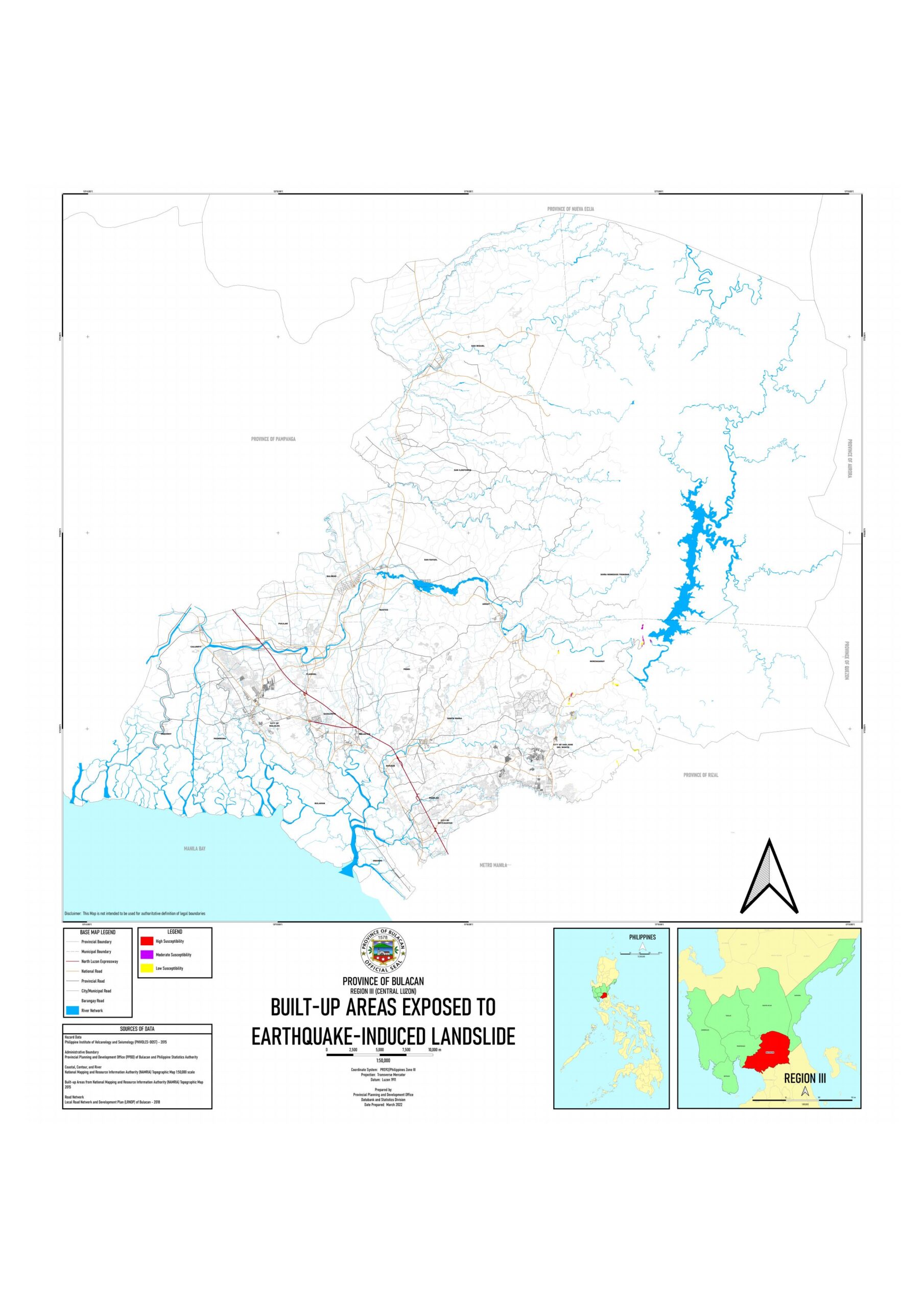 Vulnerability and susceptibility map – 8 | 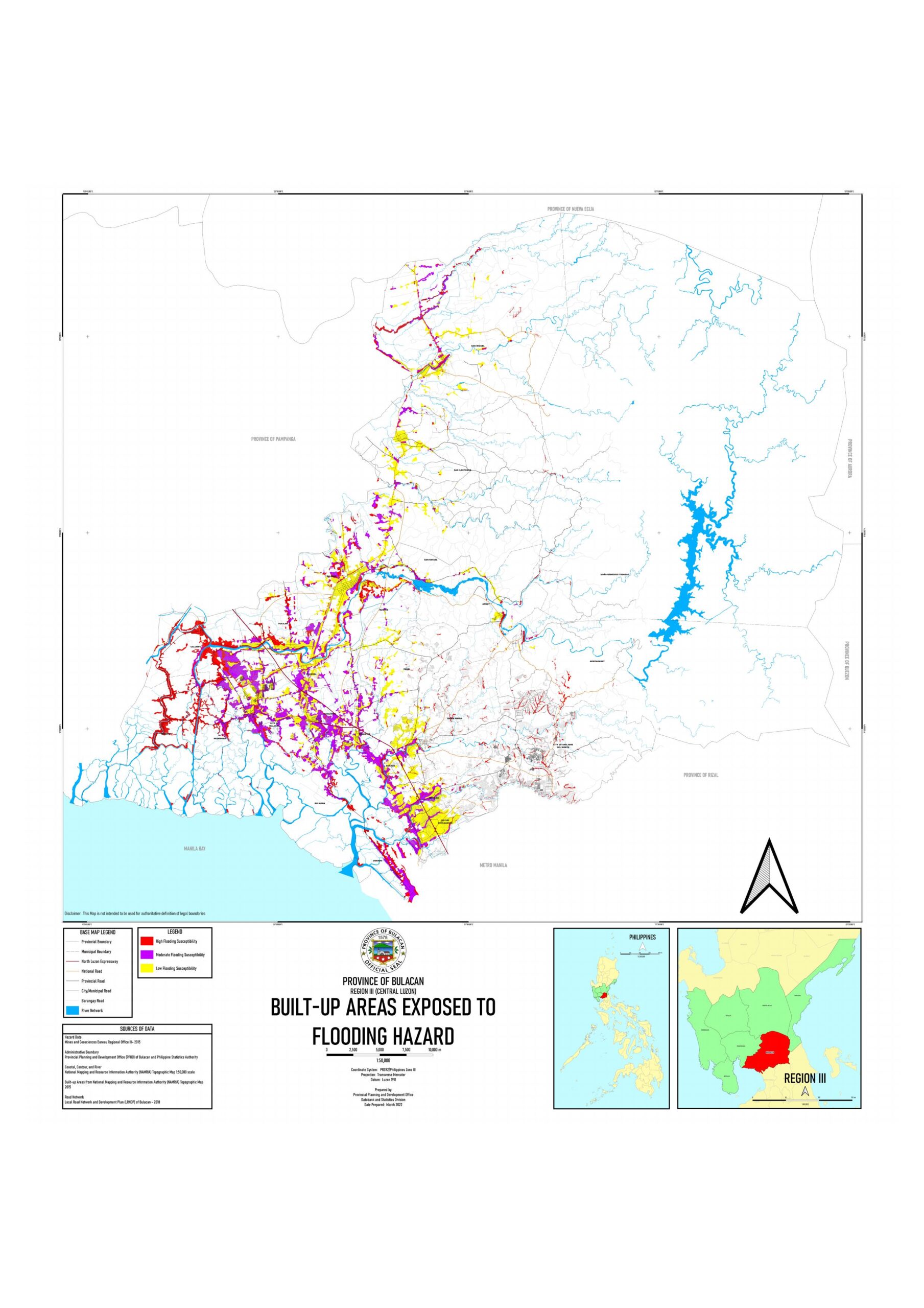 Vulnerability and susceptibility map – 9 |
 Vulnerability and susceptibility map – 10 | Vulnerability and susceptibility map – 11 | 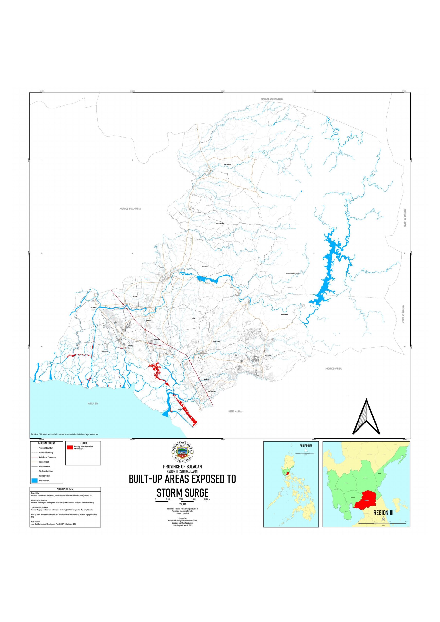 Vulnerability and susceptibility map – 12 | 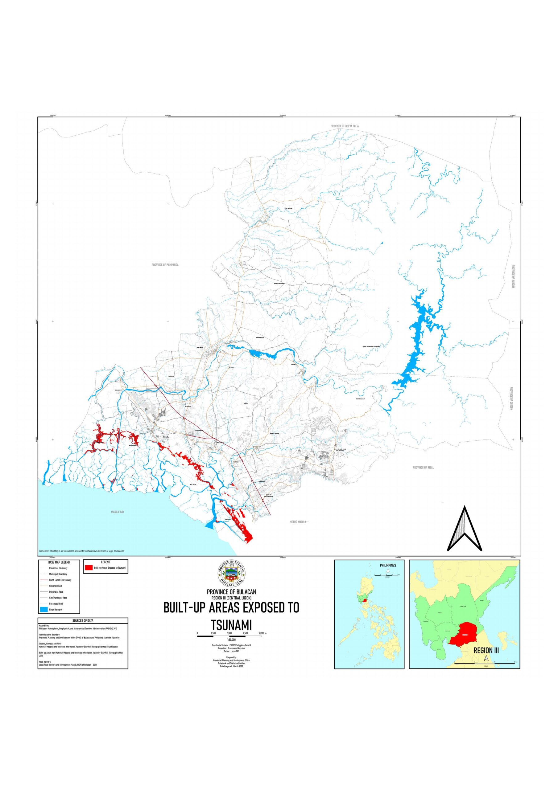 Vulnerability and susceptibility map – 13 | 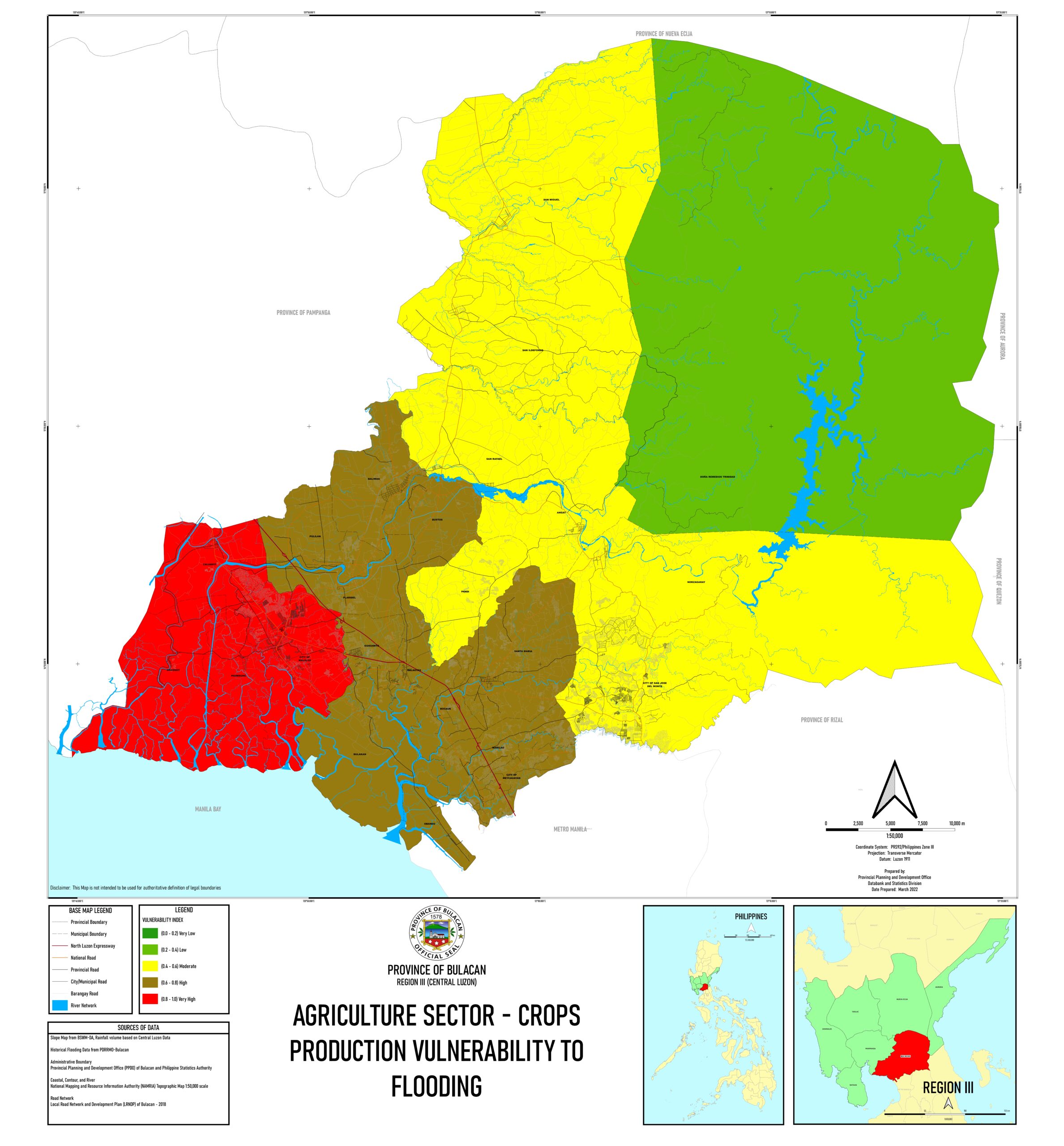 Agricultural sector-crops production vulnerability |
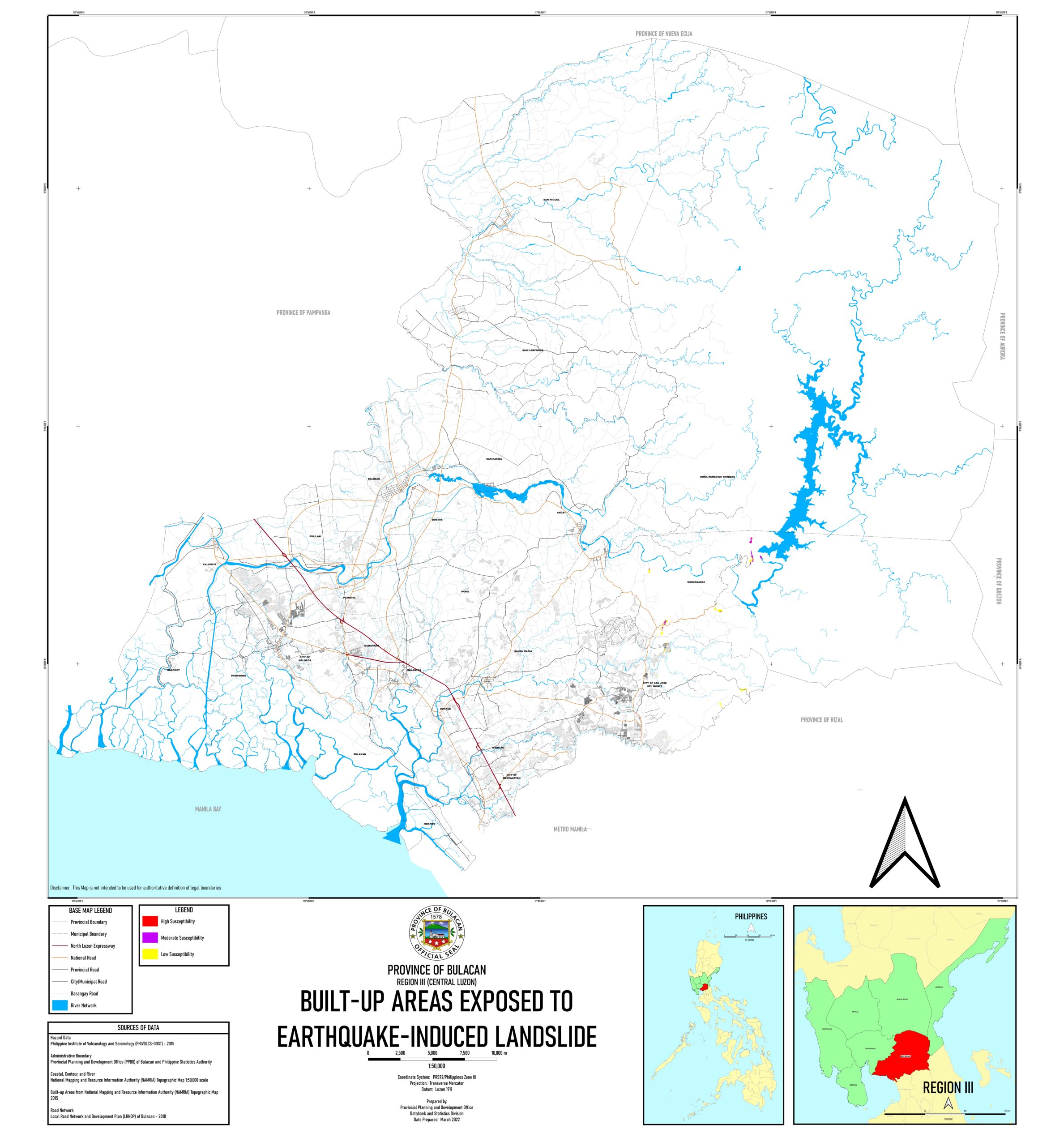 Built-up areas exposed to earthquake -induced landslide map | 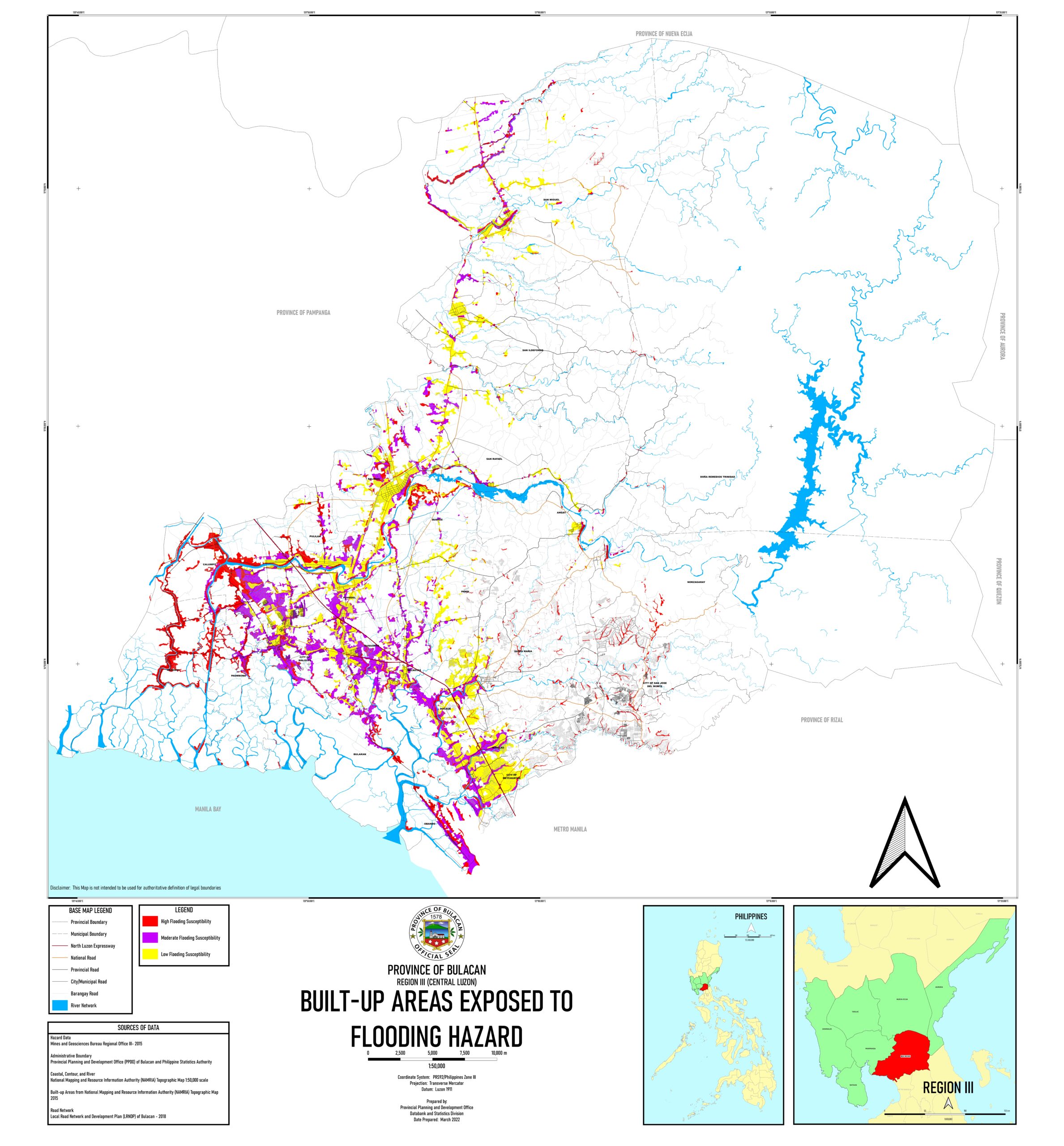 Built-up areas exposed to flooding hazard map | 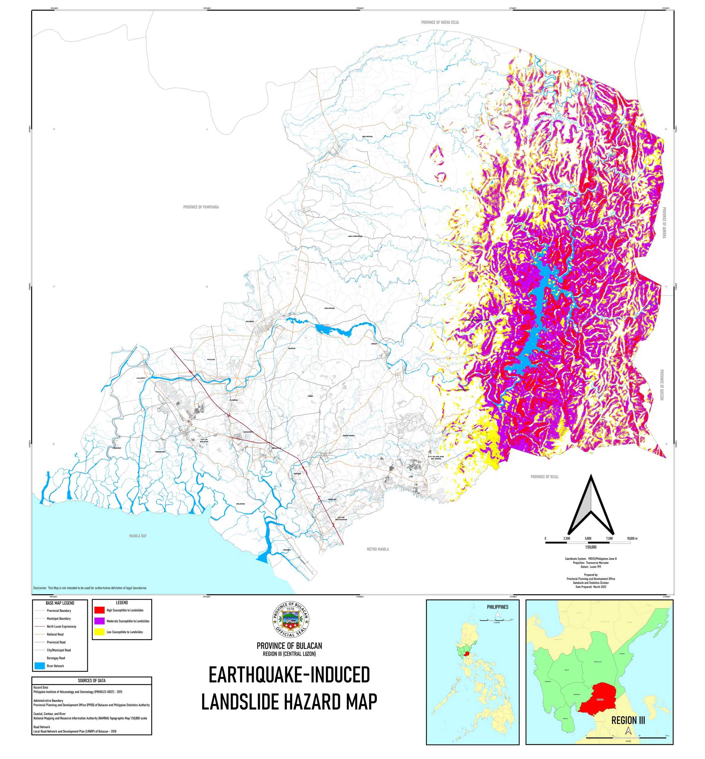 Earthquake-induced landslide hazard map | 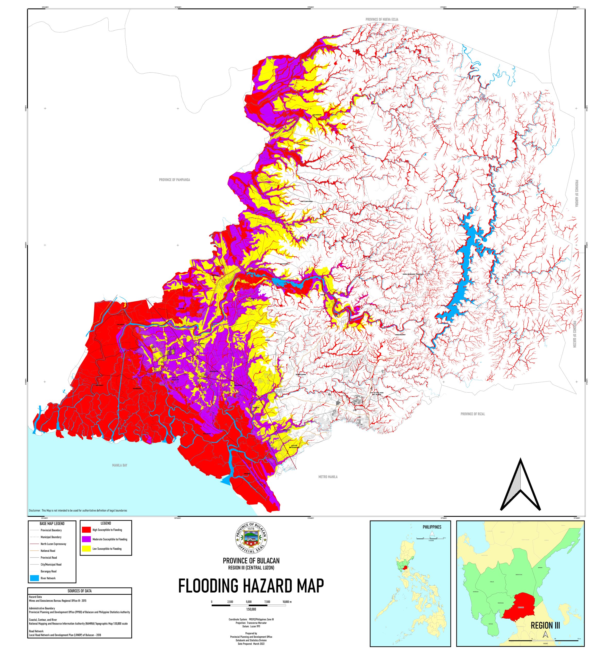 Flooding hazard map | 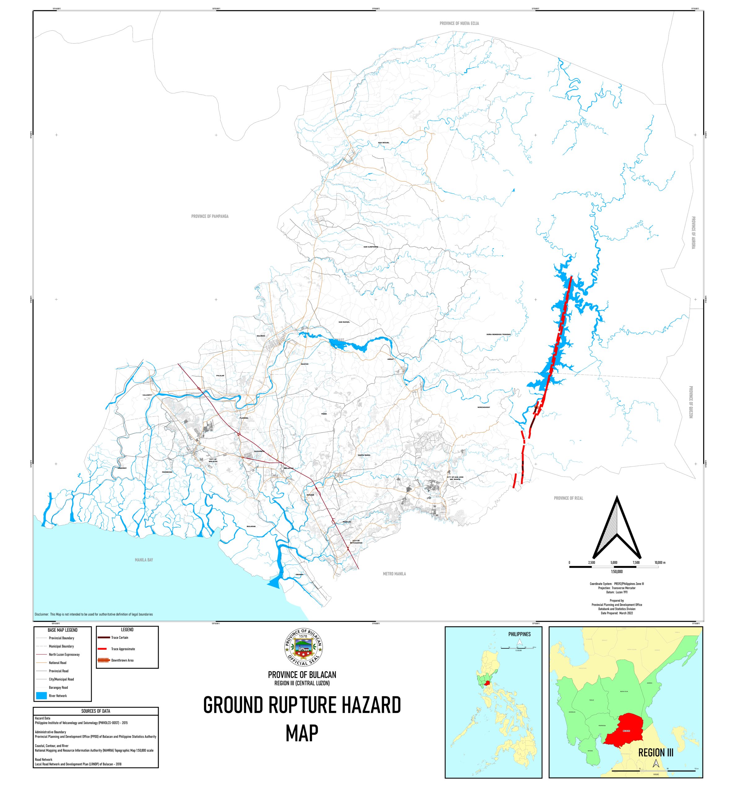 Ground rupture hazard map |
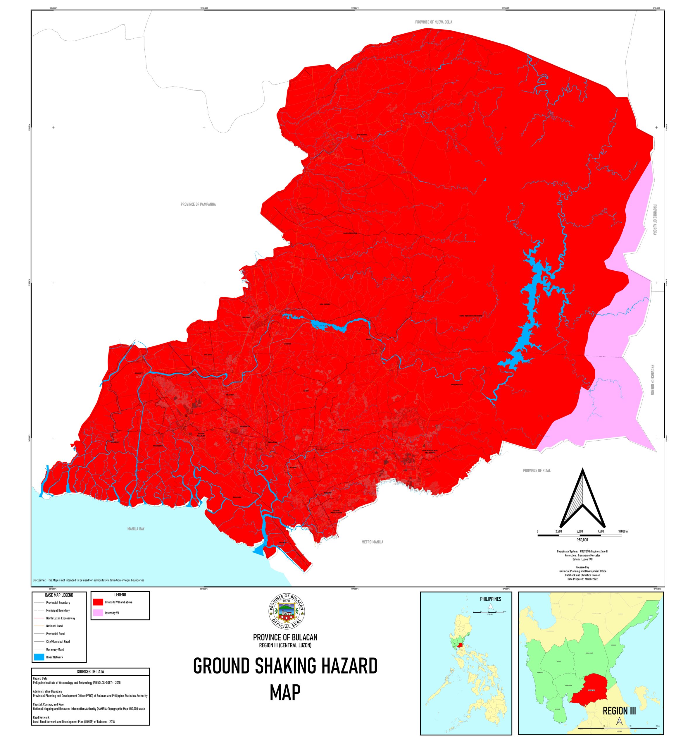 Ground shaking hazard map | 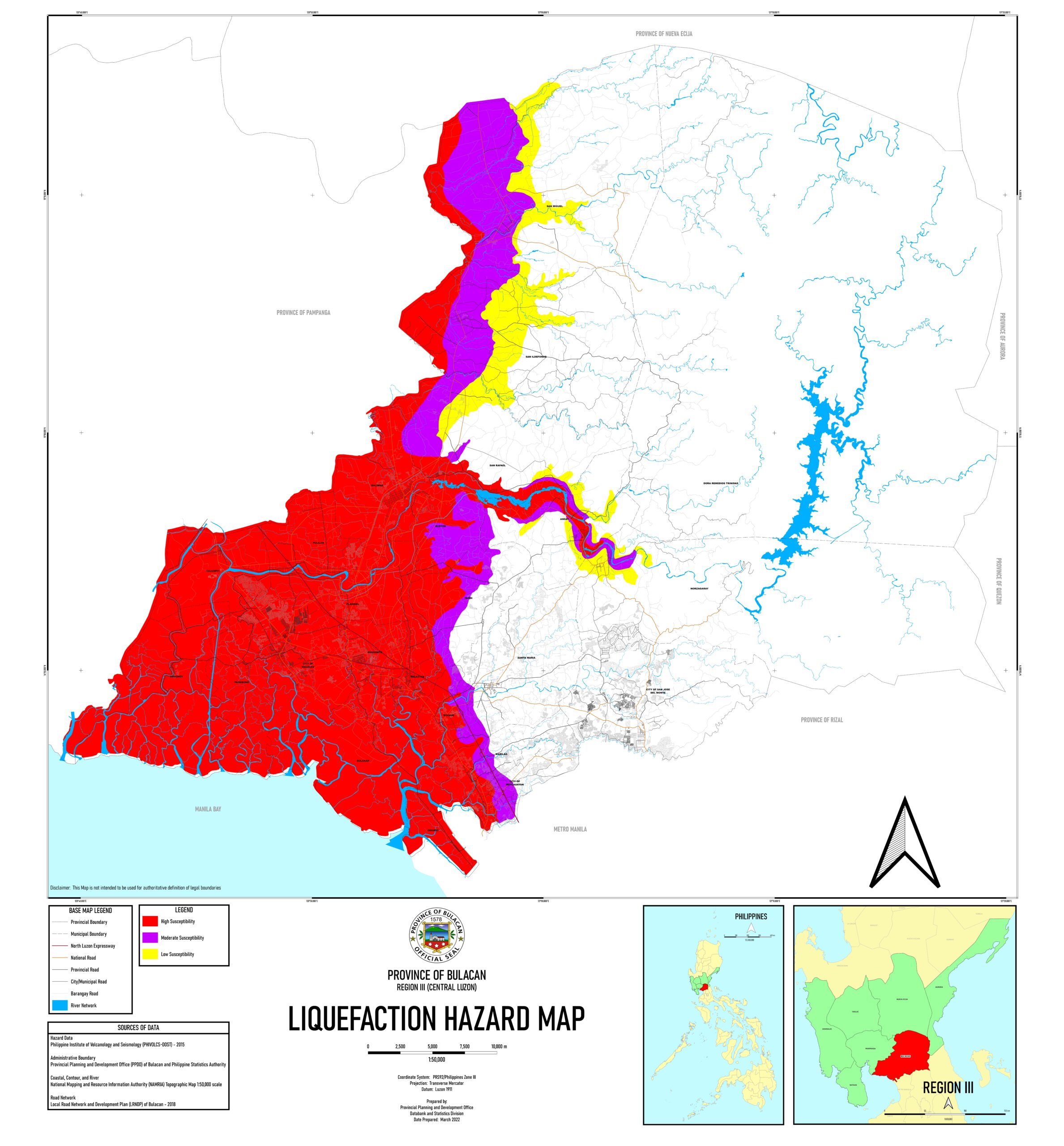 Liquefaction hazard map | 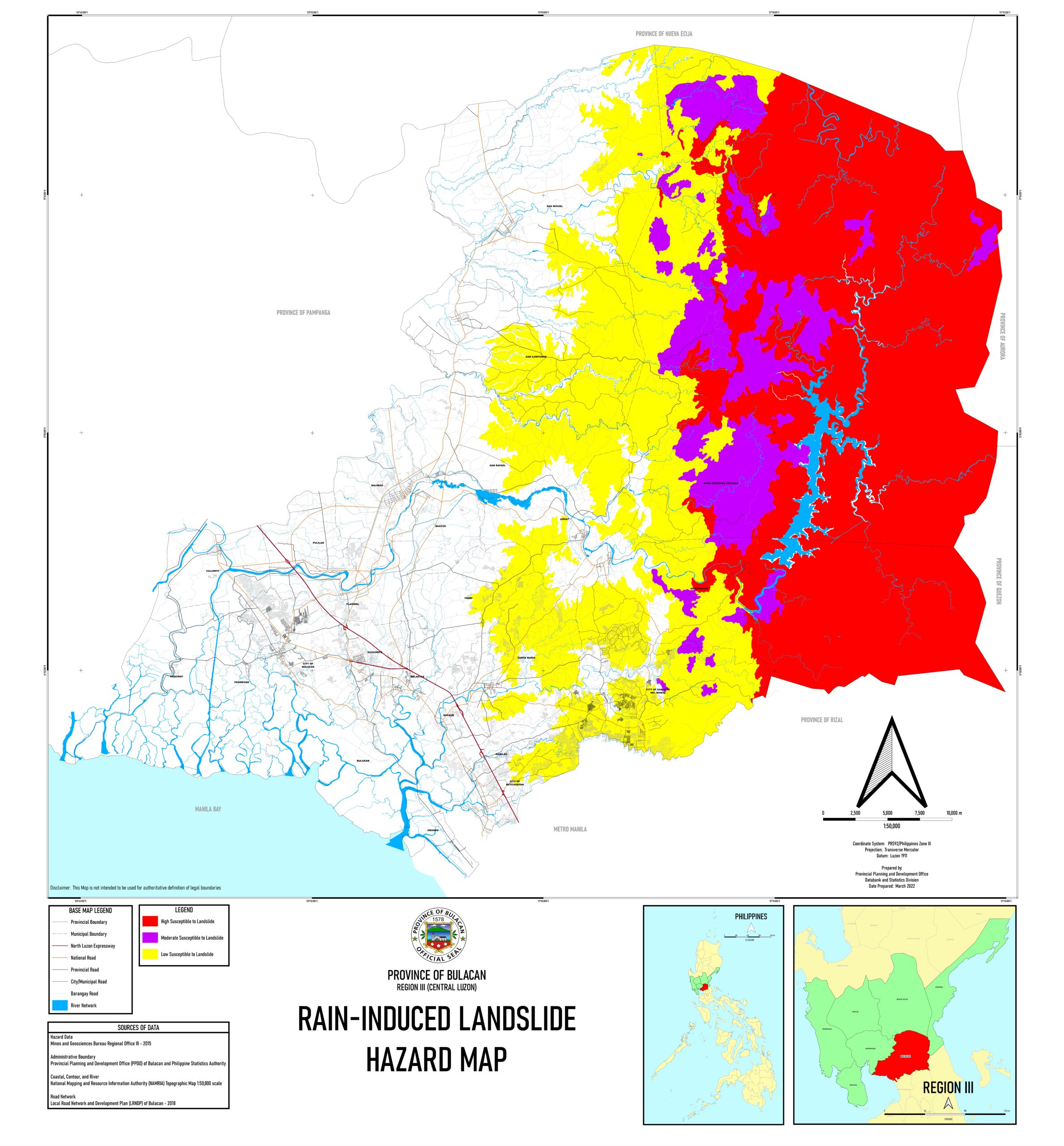 Rain-induced landslide hazard map | 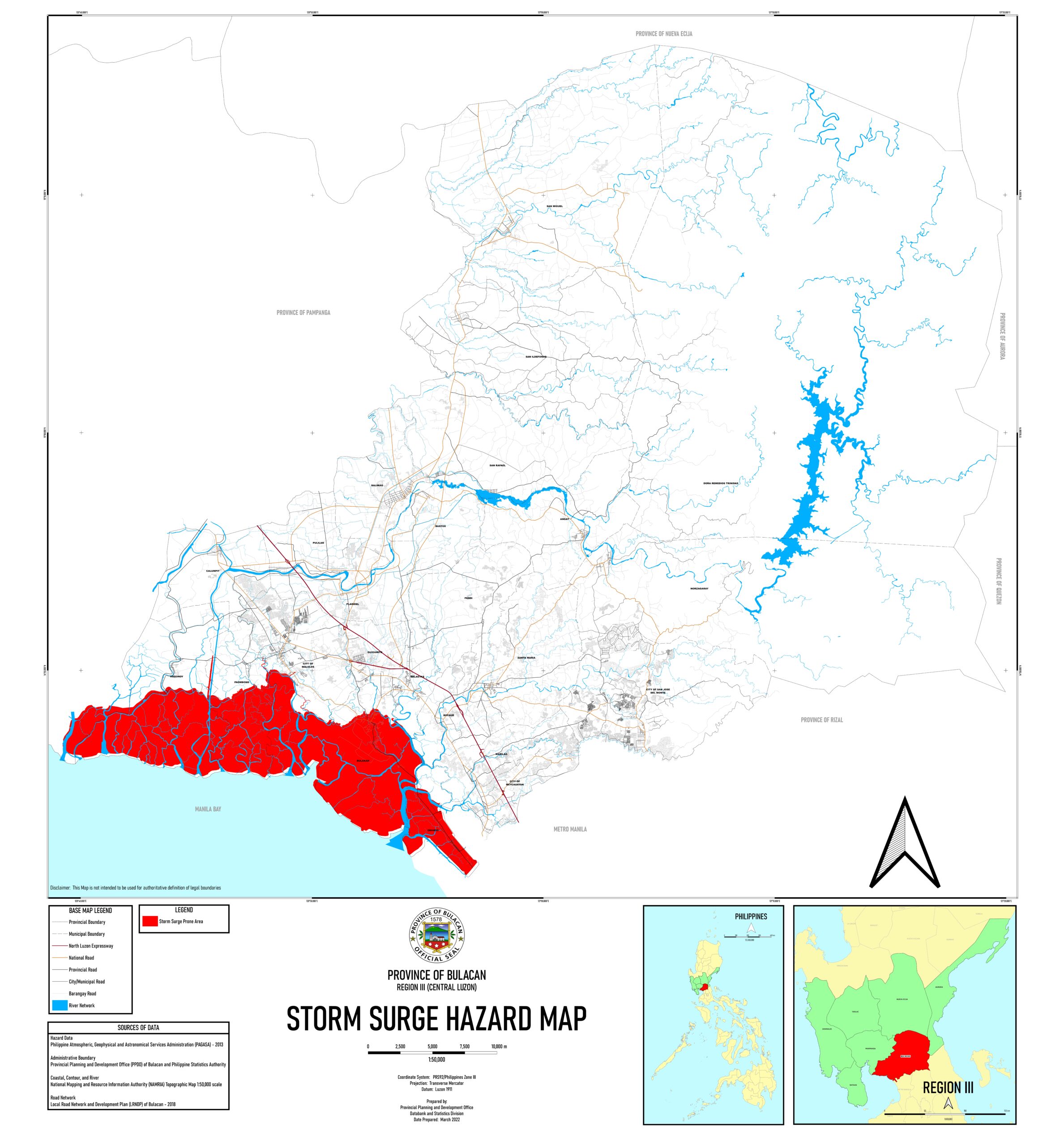 Storm surge hazard map | 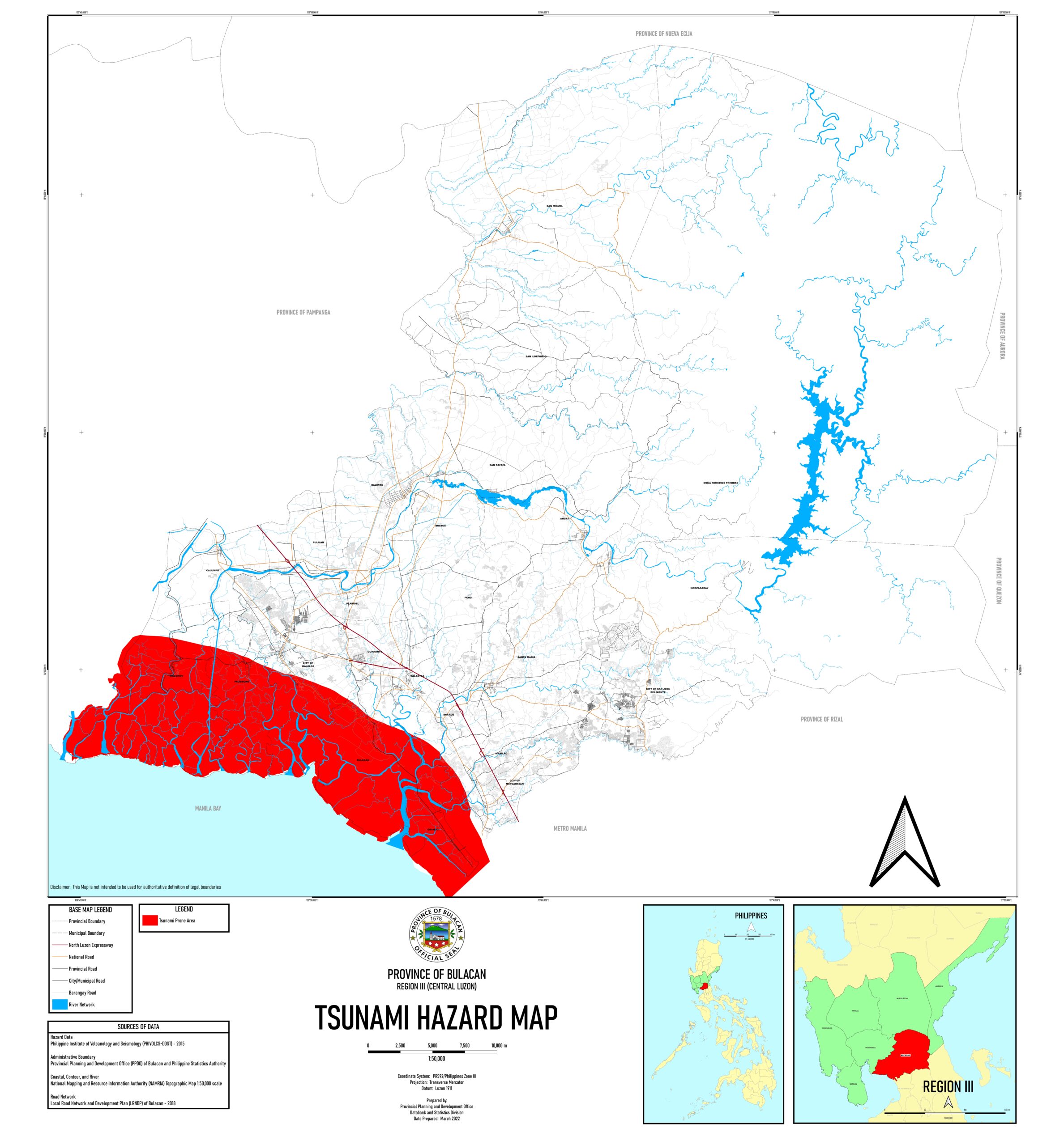 Tsunami hazard map |
Provincial Disaster Risk Reduction and Management Office Republic of the Philippines Provincial Government of Bulacan
April 26, 2024 5:30:am